


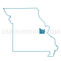
LYON Voting District, Franklin County, Missouri
About
Outline

Summary
| Unique Area Identifier | 607800 |
| Name | LYON Voting District |
| County | Franklin County |
| State | Missouri |
| Area (square miles) | 22.71 |
| Land Area (square miles) | 22.66 |
| Water Area (square miles) | 0.05 |
| % of Land Area | 99.78 |
| % of Water Area | 0.22 |
| Latitude of the Internal Point | 38.52725730 |
| Longtitude of the Internal Point | -91.18211520 |
Maps


Graphs
Select a template below for downloading or customizing gragh for LYON Voting District, Franklin County, Missouri


Neighbors
Neighoring Voting District (by Name) Neighboring Voting District on the Map
- BEAUFORT- LYON Voting District, Franklin County, MO
- CLOVER BOTTOM WEST Voting District, Franklin County, MO
- DETMOLD Voting District, Franklin County, MO
- EXCELSIOR Voting District, Franklin County, MO
- YEATES Voting District, Franklin County, MO
- ZIEGENMEYER Voting District, Franklin County, MO
Top 10 Neighboring County Subdivision (by Population) Neighboring County Subdivision on the Map
- St. Johns township, Franklin County, MO (5,078)
- Lyon township, Franklin County, MO (3,816)
- Boeuf township, Franklin County, MO (2,246)